Safer streets
Community policing, lighting, and local safety resources.
Our Ward
A community-focused campaign built around the local services, public spaces, and everyday decisions that matter to residents.
Our Ward
My connection to the ward is expressed through a campaign promise to work for residents and keep their voice at the centre of city decisions.
Local issues
The campaign’s priorities connect citywide decisions to day-to-day life in Scarborough—Agincourt.
Community policing, lighting, and local safety resources.
Transit, roads, and traffic safety across the ward.
Local programs for youth, seniors, and community centres.
A cleaner, greener Scarborough that supports local life.
Ward 22, Scarborough—Agincourt runs from Steeles Avenue East in the north to Highway 401 in the south, roughly between Victoria Park Avenue and Midland Avenue. The shaded area shows the official boundary.
View the official City of Toronto map (PDF)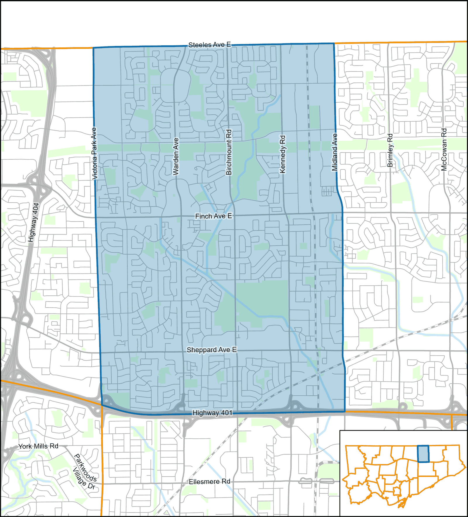
Map: City of Toronto, City Planning (Strategic Initiatives, Policy & Analysis). © 2023 City of Toronto. Boundaries are part of the City’s 25 municipal wards, effective December 1, 2018.
Get involved
Volunteer, request a lawn sign, attend campaign events, or simply start a conversation about what matters in our ward.